An Alberta address does not describe the conditions underfoot. A sheltered yard near a building can differ from an exposed rise on the same parcel, while a low area may collect water from land well beyond the proposed treatment. A zone map turns those differences into a usable brief. Its purpose is to help the appropriate contractor or specialist ask better questions before materials, rates and timing are selected.
Draw the project boundary and the larger context
Begin with the area you intend to treat, then sketch nearby features that affect it. Include buildings, roads, drains, ditches, slopes, retained trees and existing vegetation. Distinguish property boundaries from the work boundary. Record places where water enters or leaves, even if they are outside the measured application area. Those connections can be important to a site review.
Give every zone a simple identifier that will survive later revisions: Yard A, North Rise B and Low Pocket C are more useful than descriptions that change with the observer. Include the date, approximate dimensions and photograph locations. A basic sketch can be effective if its limitations are clear; a planning drawing should not be represented as a survey or engineering design.
Identify the use for each zone
Write one primary objective for every area. Is it maintained lawn, grazing forage, native recovery, temporary construction cover or another vegetation goal? Add who will use the area and what activities are expected. A zone that must tolerate frequent traffic should be discussed differently from one that will remain fenced during establishment. Avoid treating visual greenness as the only desired outcome.
The Alberta Forage Manual addresses agricultural establishment and regional adaptation, while the province's native-grassland guidance addresses conservation and restoration. Those are different contexts. Using a pasture recommendation as a residential lawn specification, or a lawn blend as a native restoration solution, skips the land-use decision that makes the information relevant.
Record exposure without pretending to measure everything
Note where sunlight is blocked, where snow tends to drift and where wind is felt strongly. Include a photograph direction and approximate observation time. A single summer visit does not establish year-round light or wind conditions, so describe it as an observation. Ask occupants or site managers about recurring conditions and identify what still needs a more deliberate review.
For an exposed acreage edge, the planning implication may be a need to examine surface protection, moisture availability and monitoring access. For a shaded strip, it may be a different vegetation choice or a reconsideration of lawn use. The zone map organizes these questions; it does not automatically prescribe a seed species or treatment based on a compass direction.
Describe the soil evidence you have
Separate appearance from analysis. Dark colour, a load described as screened topsoil and a laboratory report are three different kinds of information. Record source documents for imported soil, observed debris, apparent layer changes and any known construction traffic. If a soil investigation is required, have the responsible adviser define the sampling locations, depth and tests for the vegetation objective.
AAFC explains that soil texture influences water movement and management. That principle is a reason to investigate differences rather than assume all zones need identical amendments. Label a visual assessment as provisional, and avoid making a fertilizer or soil-treatment plan from colour alone. Keep test results tied to a mapped location so a later recommendation applies to the intended ground.
Trace water with repeatable observations
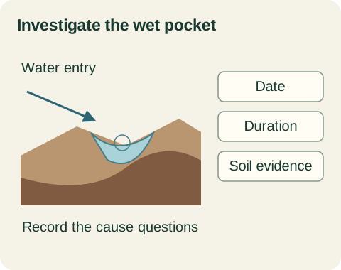
Inspect the site safely after appropriate weather events and record ponding, sediment deposits and visible channels. Photograph a fixed reference point so later images can show change. Ask where the water originated and whether a planned grade, drain or temporary control was involved. An area that looked dry at the quoting visit may behave differently during rain or snowmelt.
Do not redirect water or excavate a suspected problem merely to improve the map. Drainage changes can affect neighbours, infrastructure or sensitive areas and may need qualified review and approvals. The useful homeowner action is to document the pattern and flag it in the brief. The map should show both the observed issue and the person responsible for assessing its cause.
Retain existing vegetation information
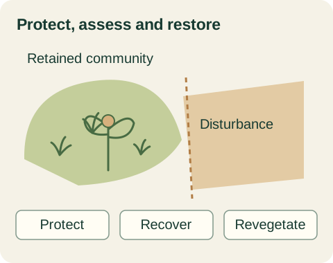
Mark areas with established vegetation that could be protected instead of disturbed. If native grassland may be present, pause the assumption that clearing and reseeding is an improvement. Alberta's guidance emphasizes minimizing disturbance and considering appropriate native restoration where disturbance cannot be avoided. The identity and condition of existing vegetation may need a specialist assessment before a treatment boundary is finalized.
Map weeds separately from the desired vegetation. Use tentative labels for plants you cannot confidently identify, take useful close photographs and request identification. This distinction matters because total plant cover can hide a problem species. Include adjacent areas that may be a source of future weeds so the project does not end at the edge of the application drawing.
Add logistics and establishment capacity
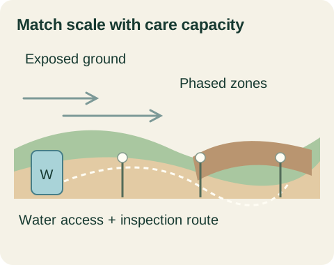
Record truck access, gates, turning space, hose routes, water-source information and places that must remain accessible. Include who owns or controls each required resource. If a contractor cannot reach a zone without crossing prepared soil, ask how the work sequence will manage that constraint. Access assumptions should be visible in the quote rather than discovered on application day.
Then name the person who can inspect each zone afterward. A remote field edge may be checked less frequently than a yard outside a kitchen window. Establishment planning should reflect that practical difference. Assign a route, observation locations and a method of reporting problems, with event-based visits added when the project specification or conditions require them.
Convert the map into a scoped conversation
Imagine a parcel with a maintained 300 m² yard, a disturbed 900 m² access verge and a retained native edge. The owner proposes three separate objectives and shares one map. The yard needs a household care plan; the verge needs exposure and runoff review; the native edge needs protection and a decision about disturbance. No universal rate is applied across all three.
Before requesting work, review the unanswered questions zone by zone. List the adviser needed, the information to obtain and the decision that cannot yet be made. A completed assessment brief does not mean the site is approved for treatment. It means the next conversation can address specific conditions, responsibilities and boundaries without relying on a broad provincial label.
Sources + further reading
- Government of Alberta: Guidelines for native grasslands
- Government of Alberta: Alberta Forage Manual
- Agriculture and Agri-Food Canada: Soil texture and water quality
Source review: 2026-10-04. Requirements and programs can change; confirm the current details with the authority or provider.