An acreage plan can fail at the scale of its responsibilities. A household able to inspect a small yard each day may be unable to reach, water or monitor a distant disturbed area in the same way. Before choosing an application, define the vegetation objective, exposure, water strategy and realistic care capacity for each zone. A larger area estimate should expand the planning questions as well as the material quantity.
Choose the land use deliberately
Distinguish maintained lawn near the home from forage, native recovery, a road verge or temporary construction cover. Each objective can require a different specialist and specification. Write down whether mowing, grazing, traffic or ecological function is expected and what future management is available. A broad acreage-lawn label may hide several decisions that cannot be resolved by one blend.
The Alberta Forage Manual describes regional differences in moisture, winter hardiness and growing conditions for agricultural forage. It does not supply a lawn prescription for every parcel. Use that regional context to ask about adaptation, then connect the answer to the actual land use. An exposed southern site and a sheltered northern site should not be treated as equivalent merely because both are in Alberta.
Map exposure and contributing land
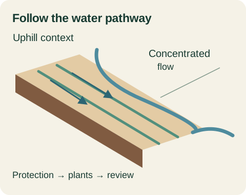
Record open fetch, shelter, slope breaks and areas where bare soil connects to adjoining land. Identify visible wind movement, deposited sediment or recurring runoff paths. Photographs with directions and dates help distinguish an observation from a general impression. Include nearby work that could change the conditions during establishment, such as a new road, removed windbreak or continued grading.
AAFC identifies the Prairies as an important wind-erosion context and explains that control depends on land characteristics and weather. The planning response is to seek a site-appropriate protection strategy, not to assume a particular hydraulic product is sufficient. Ask which exposure conditions the proposed treatment addresses, which it does not, and who specifies any additional protection.
Establish what the water source can actually support
Identify the source proposed for application and any subsequent establishment care. Record ownership, access, delivery arrangements and permissions. If a well, storage tank or hauled supply is involved, have the relevant capacity and constraints assessed rather than assuming it can support the full area. The portal does not estimate an acreage's required water volume from area alone.
Ask how water distribution would reach the farthest zone and who operates it. A theoretical supply can still be impractical if labour, equipment, access or lawful use is unresolved. Document what happens when the source is unavailable or conditions change. If the plan depends entirely on rain, say so clearly and discuss the resulting timing and establishment uncertainty with the responsible adviser.
Avoid promising weather from historical averages
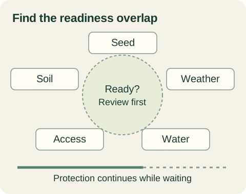
Historical climate information can help compare regional context and discuss seasonal risk. ECCC's climate normals are station-based statistics, not a forecast for the coming weeks. They cannot guarantee the rain events needed by a particular newly seeded area. Combine climate context with current forecasts, observed ground conditions and the specified vegetation's establishment requirements.
Use a simple risk statement in the brief: the chosen method assumes a named water strategy, access arrangement and review process; these may need adjustment if conditions change. This is more useful than choosing a date because a calendar says rain is typical. Identify who can authorize a postponement or phase change before the crew and materials are committed.
Match the treatment boundary to care capacity
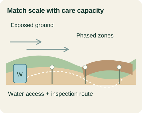
Consider dividing work into zones that can be monitored and managed reliably. Phasing should follow site risk and project requirements, not an arbitrary maximum area. Ask whether temporary protection is needed on zones waiting for treatment and who maintains it. A phased plan still needs a complete protection strategy for the exposed ground outside the active work area.
For a hypothetical 6,000 m² disturbance, the owner may have practical care access to only a portion near the house. The brief should disclose that difference. The contractor or specialist can then compare a staged treatment, another method or revised management arrangement. Multiplying a small-yard watering routine by thirty without checking the resource and labour assumptions is not a credible acreage plan.
Arrange access without repeatedly disturbing prepared ground
Mark vehicle tracks, gates, turning locations, wet crossings and areas to avoid. Confirm whether the proposed equipment can reach the zones and where materials or water will be staged. A route that works in dry conditions may need reassessment after rain. State who decides whether access is suitable and how the site remains protected if the work is delayed.
Use separate routes for application work and later observation where practical. Document any temporary access that will be restored afterward. The person inspecting a remote zone should know the boundary, hazards and contact process. Do not create a monitoring plan that assumes unsafe walking on steep ground or driving across a fragile new surface simply to collect photographs.
Build a remote observation system
Set identifiable photo points and representative observation locations in contrasting zones. Record how the inspector will distinguish intended vegetation, unwanted plants, exposed soil and carrier material. A distant green impression is insufficient to assess composition or connected bare areas. If qualified identification is required, plan for it rather than assigning the task to an unprepared caregiver.
Decide how observations reach the responsible decision maker. Include a map, dates and the action taken after each reported issue. Weather-triggered or specification-required inspections may be additional to planned routine visits. The time planner can estimate effort using entered visit assumptions, but it cannot determine the required frequency or certify the adequacy of an acreage monitoring program.
Test the brief against a difficult week
Imagine a treated access verge, a dry forecast and a temporary loss of hauled-water access. The written plan identifies who checks the site, what permitted resources remain and when the specialist must review the situation. The owner can address the actual constraint instead of assuming an unseen distant zone is progressing like the sheltered yard near the house.
Review the plan before work with one practical question: who can carry out every required action under the conditions we have described? If a responsibility has no person, resource or safe route, resolve it or revise the scope. A credible acreage request explains that operating plan alongside the measured area and seed specification.
Sources + further reading
- Government of Alberta: Alberta Forage Manual
- Agriculture and Agri-Food Canada: Soil erosion
- Environment and Climate Change Canada: Canadian Climate Normals
Source review: 2026-10-04. Requirements and programs can change; confirm the current details with the authority or provider.